×
Maritime Surveillance System
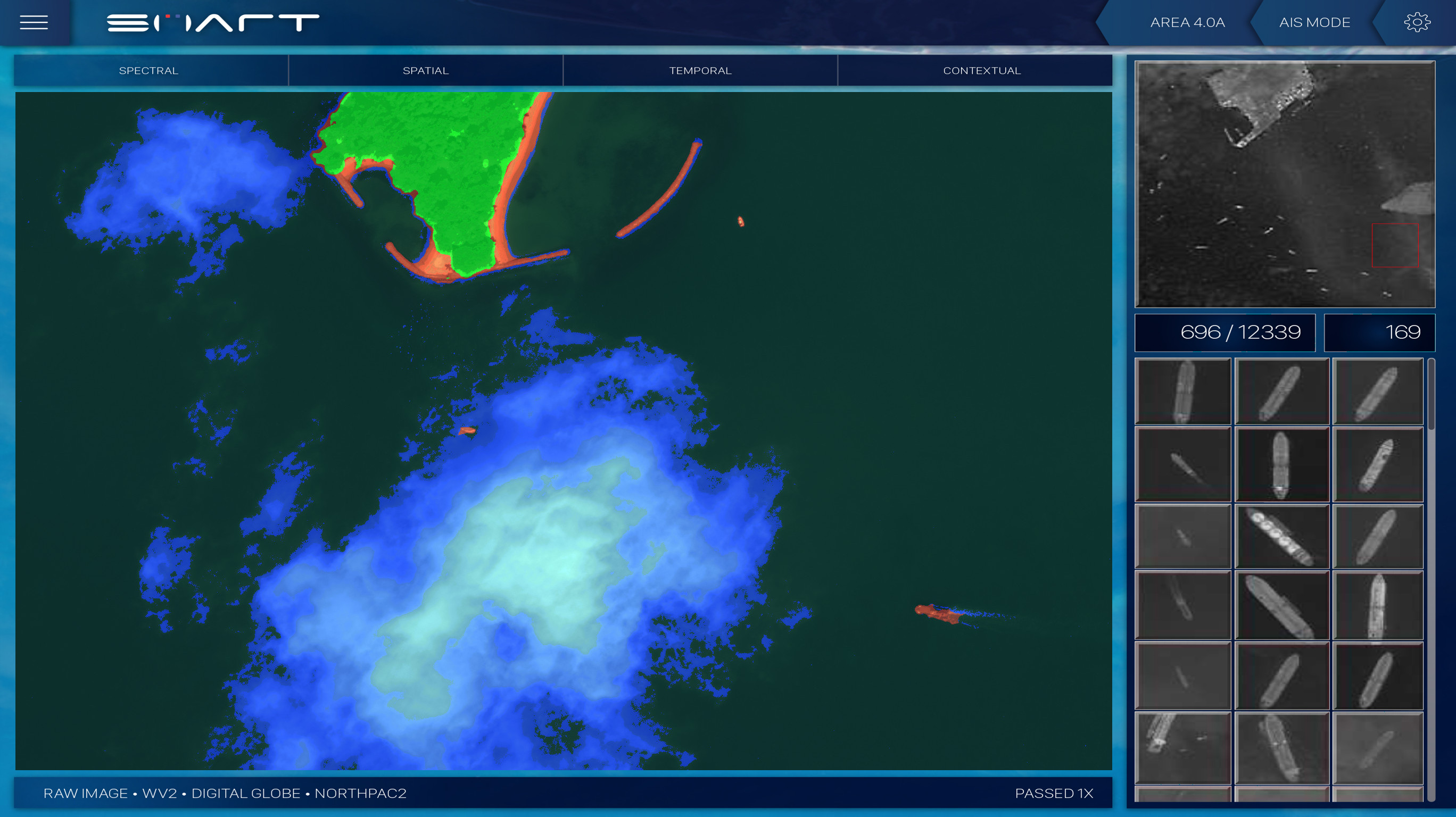
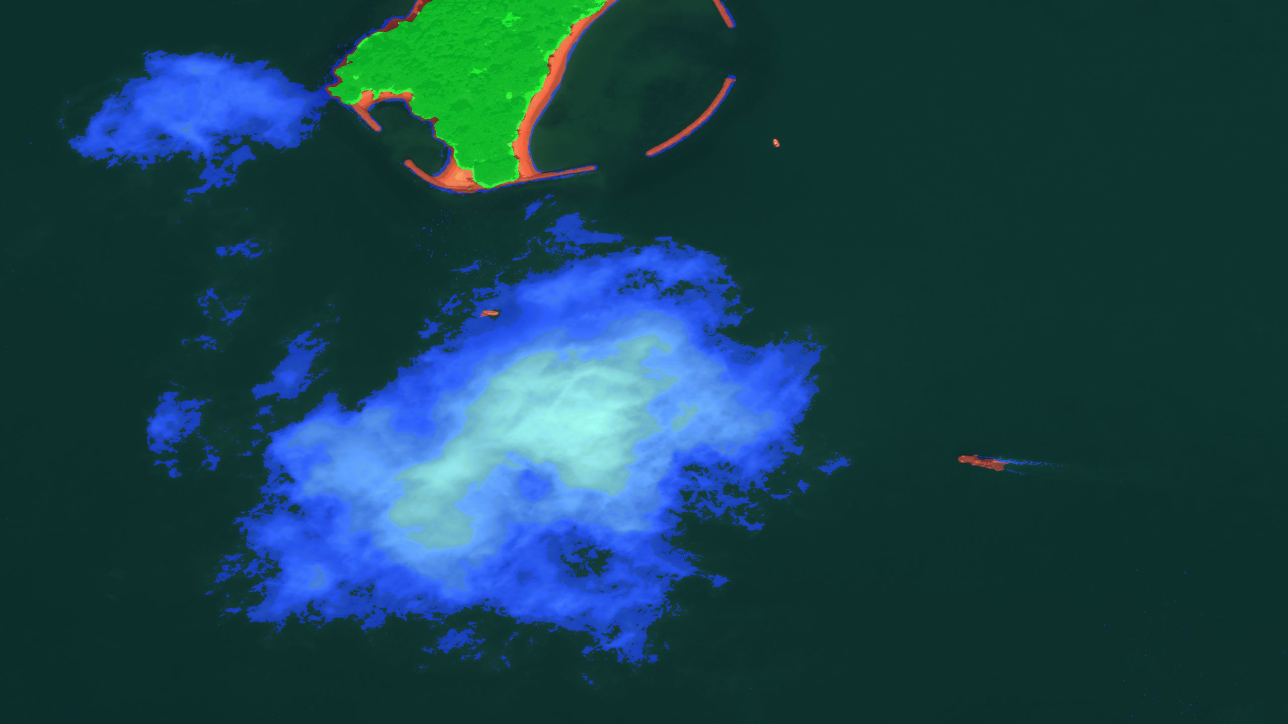
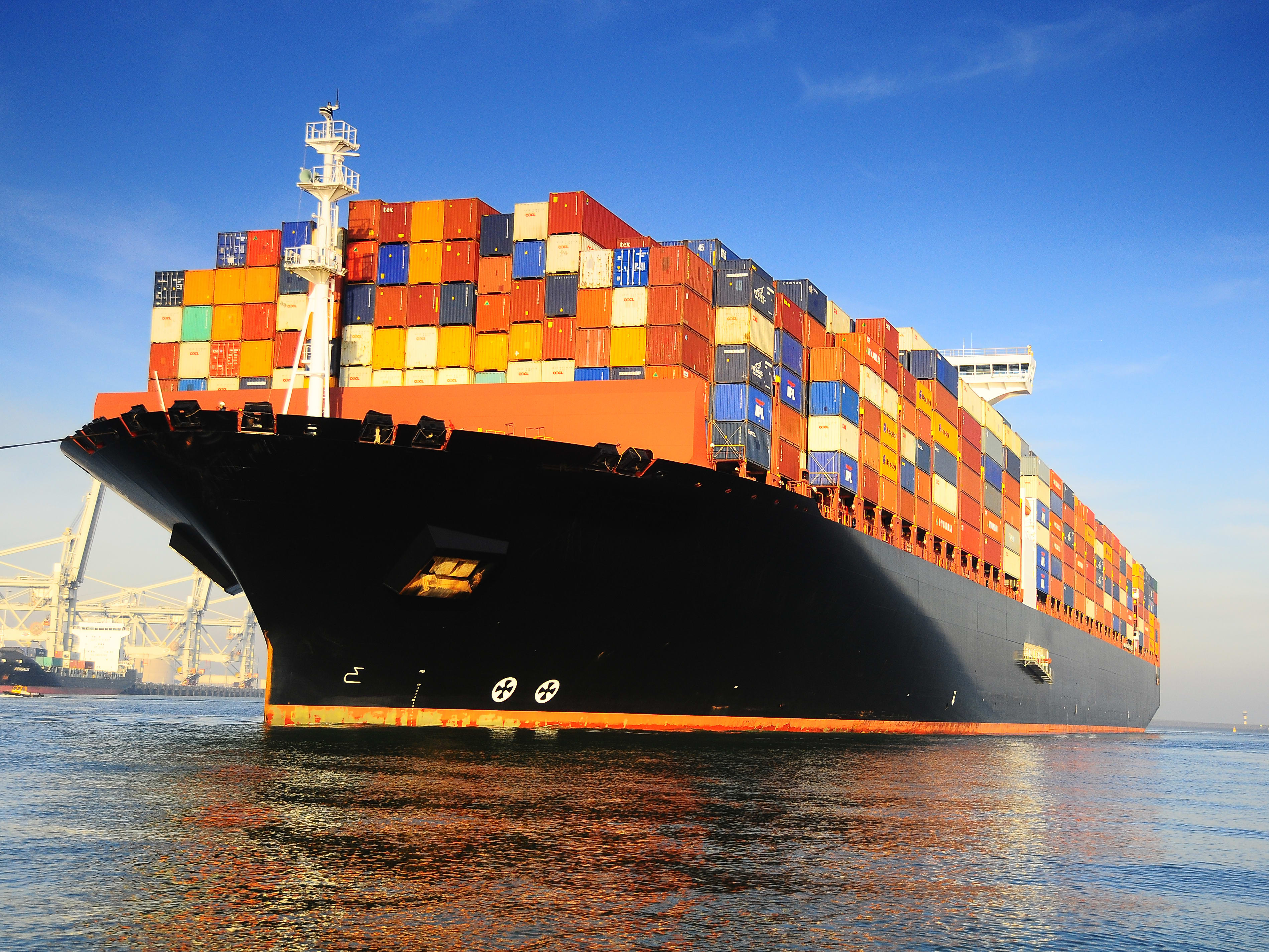
Ship detection and AIS matching system used in coastal monitoring for real-time maritime security.
Ship detection and AIS matching system used in coastal monitoring for real-time maritime security.
Spatial Mapping delivers cutting-edge computer vision AI solutions for surveillance, maritime detection, and smart infrastructure. We turn complex visual data into actionable intelligence.
Spatial Mapping is a leader in computer vision AI consulting, delivering innovative solutions that transform how organizations perceive and interact with visual data.
To empower organizations with transformative computer vision technologies that solve complex challenges and create new opportunities across industries.
To be the global leader in AI-powered computer vision solutions, setting the standard for innovation, accuracy, and real-world impact in visual intelligence.
We combine deep technical expertise with a collaborative approach to develop tailored AI solutions that deliver measurable results and long-term value.
We offer specialized computer vision AI consulting services across various domains, from early-stage prototyping to full production deployment.
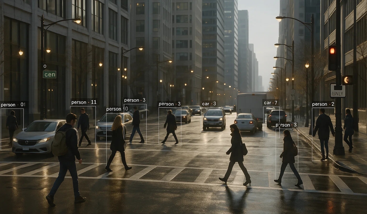
Advanced computer vision systems for intelligent monitoring and threat detection in critical infrastructure and public spaces. Our solutions prioritize both security and privacy.
High-speed remote sensing solutions for ship detection, AIS matching, and scene classification in maritime environments, enhancing safety and security at sea.
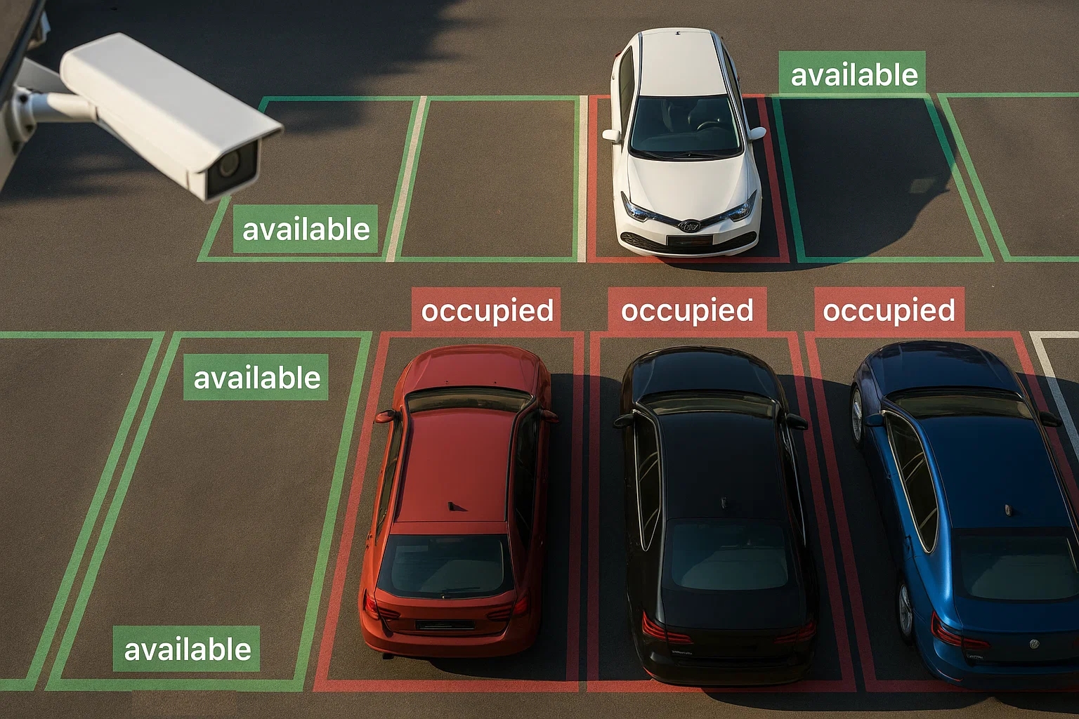
Intelligent computer vision systems that transform urban infrastructure into responsive environments capable of real-time monitoring and adaptation.
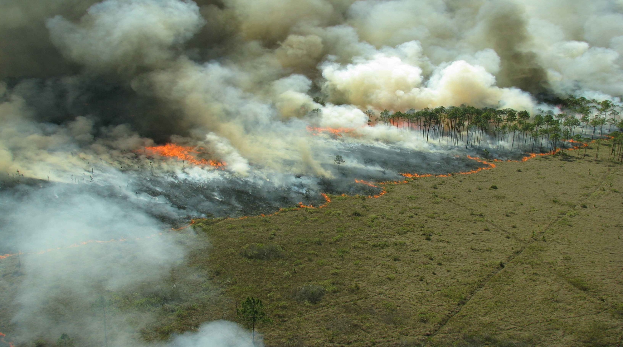
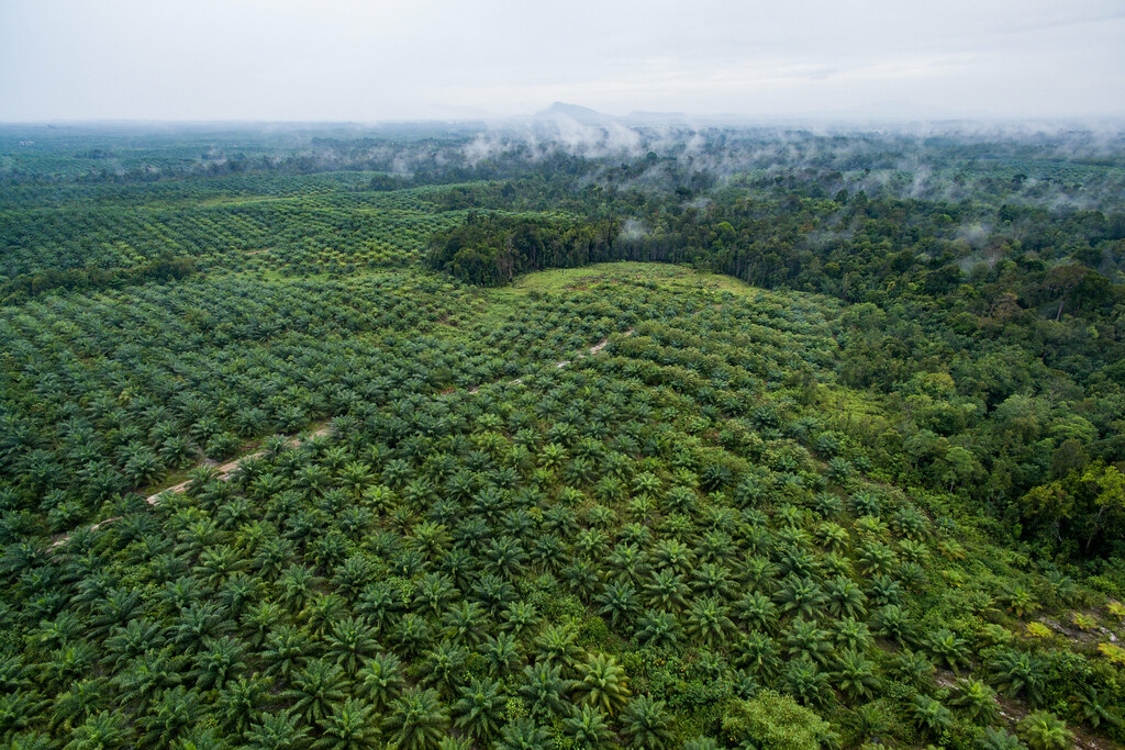
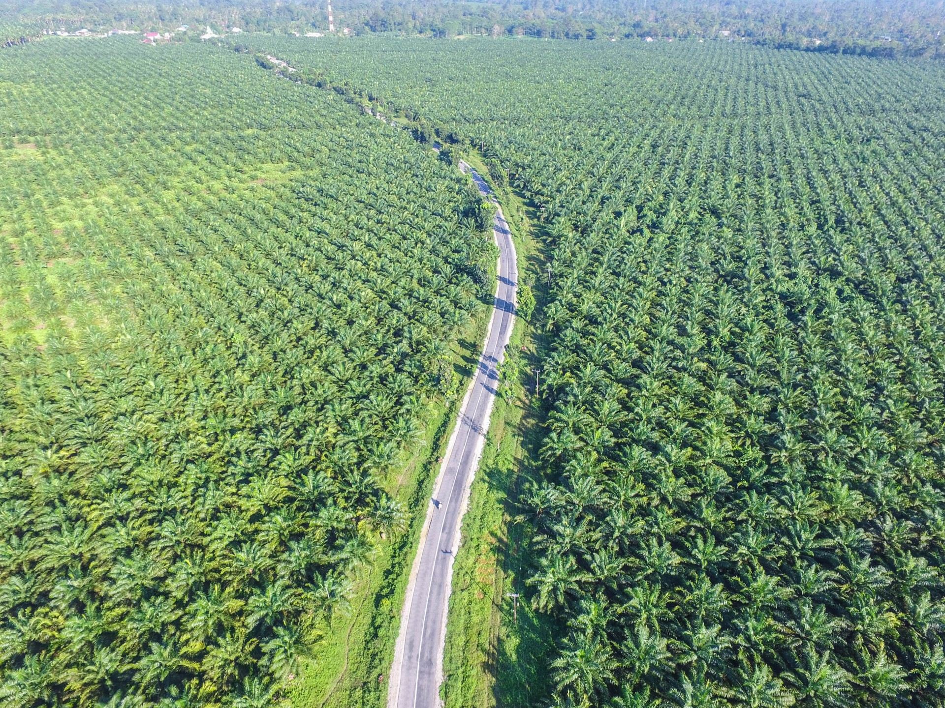
Models and Algorithms for crop monitoring, wildfire detection, smoke removal, and damage assessment using satellite and airborne imagery
Mission-driven computer vision solutions for mobile applications - enabling developers and entreprenuers to focus on on their core business and goals.
Enterprise-grade data encryption (PGP, tokenization) solutions ensuring the highest levels of security and compliance for AI system deployments.
Explore our portfolio of innovative computer vision AI solutions deployed across various industries.

Meet our team of expert computer vision scientists, AI engineers, and industry consultants.
Chief AI Scientist
Computer Vision Lead
Deep Learning Specialist
Solutions Architect
Hear what our clients have to say about working with Spatial Mapping.
Director of Maritime Security, OceanGuard
Chief of Environmental Protection, ForestShield
CTO, SmartCity Solutions
Ready to transform your visual data into actionable intelligence? Get in touch with our team.
100 Innovation Drive, Suite 500
Boston, MA 02110
Monday - Friday: 9:00 AM - 6:00 PM